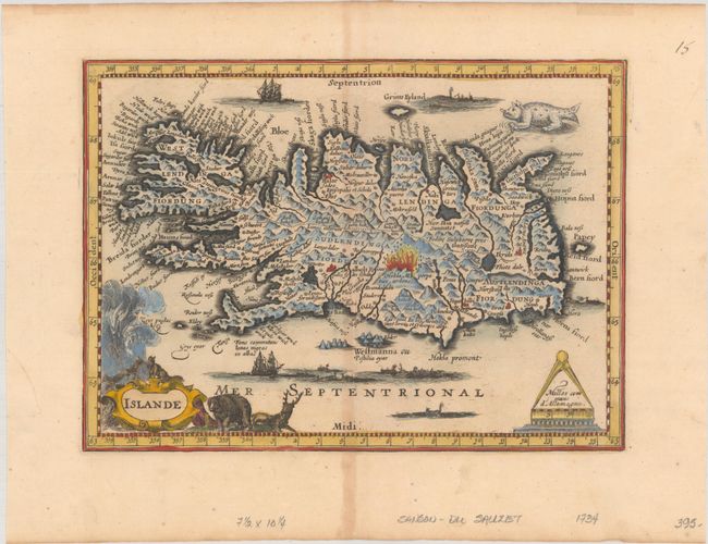
Subject: Iceland
Period: 1734 (published)
Publication: Atlas Portatif
Color: Hand Color
Size:
9.9 x 7.2 inches
25.1 x 18.3 cm
This is a rare edition of the reduced version of Mercator's map of Iceland, with cartography based on the work of Icelandic bishop, cartographer, and mathematician Gudbrandur Thorlaksson. It features myriad place names, lakes, rivers, mountains, glaciers, and fiords. Mount Hekla is depicted in the midst of a fiery eruption. Published in Henri Du Sauzet's 1734 edition of the Mercator/Cloppenburg atlas, this is a new engraving exclusive to his edition, with a new French title cartouche surrounded by wildlife, and the moiré pattern in the sea replaced with sailing ships and whaling scenes. It retains the compass-themed distance scale cartouche and fantastic furry sea monster at top right. Blank verso.
References: Van der Krogt (Vol. III) #1250:353.2.
Condition: B+
A nice impression with light toning along the centerfold.


