Subject: Middle East
Period: 1700 (circa)
Publication:
Color: Black & White
Size:
18.5 x 12.7 inches
47 x 32.3 cm
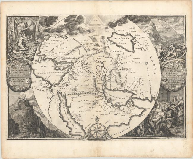
The standard group of maps included in Dutch Bibles consists of a world map, a map of Paradise, a map of the Exodus, a map of Israel divided among the Tribes, a map of Canaan, a plan of Jerusalem, and a map of the travels of St. Paul. This is one of the most unusual and decorative maps depicting the region of Paradise. It covers the area from Asia Minor to India and all of the Arabian peninsula within a circle. The Garden of Eden is located at center. At the top is the Tetragrammaton in a triangle. Surrounding the map are four scenes: Adam and Eve in the Garden, Noah's Ark after the Deluge, Moses receiving the Ten Commandments, and the birth of Christ.
References: Laor #341; Poortman & Augusteijn #154.
Condition: B+
A dark impression on a watermarked sheet with a few minor spots in the image and faint toning along the centerfold. A short centerfold separation in the bottom blank margin has been archivally repaired on recto, and there is some archival reinforcement on the left and right sheet edges on verso.


