Subject: United States
Period: 1864 (dated)
Publication:
Color: Black & White
Size:
19.8 x 14.8 inches
50.3 x 37.6 cm
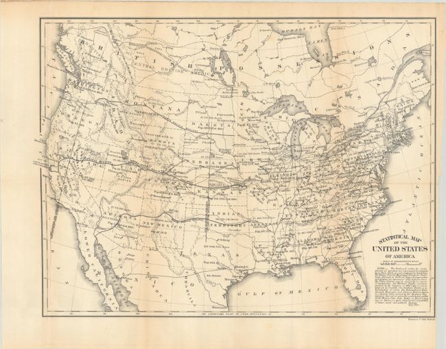
This map shows alternate railroad routes to the Pacific, including those under construction and proposed. Wyoming is shown as Transferred to Dakota, a unique term so it is interesting the map is not included in Blevins fine reference "Mapping of Wyoming." Arizona controls the southern portion of Nevada to include Las Vegas. Each state and territory is shown with major towns, railroads, populations and area in acres. Resources are located including gold in Arizona, Montana and the Black Hills in a large Dakota Territory. The silver regions are located in Arizona and Nevada. In Utah, Fillmore City is the capital and has a Cotton Region nearby. Extensive note beneath the title discusses railroads and reads, in part, "the North Mexican line from Austin in Texas to Guaymas in Sonora, is quite conjectural - a possibility of future social and political changes." The map extends to show part of Canada to include the Cariboo Gold Field and numerous forts including Moose, Severn, Petty, Garry, Ellice, Pitt, Thompson and Edmonton. Wheat found the map interesting enough to illustrate on page 108 and devote an entire page to its description. An interesting map that was published by the Treasury Department and printed by Bowen & Co.
References: Wheat (TMW) #1110; Phillips (Maps) p. 913.
Condition: B+
Issued folding with light toning along the fold lines and an extraneous crease along the left border. Trimmed close to the border at lower right with a 1" binding tear that has been closed on verso with archival materials.


