Subject: Western United States, Railroads
Period: 1877 (dated)
Publication:
Color: Hand Color
Size:
36.9 x 23.1 inches
93.7 x 58.7 cm
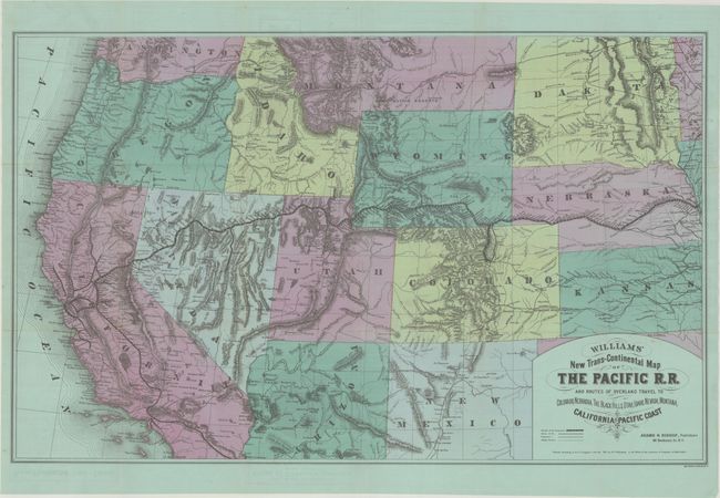
This scarce map by Henry T. Williams shows the Pacific Railroad stretching from Omaha west to San Francisco, like a vein coursing across the American West. Originally published in 1876 in Williams' Pacific Tourist, this is an example of the second edition published by Adams & Bishop. Williams was one of the earliest publishers to cash in on the western travel craze engendered by the transcontinental railroad. His map edges into persuasive cartography territory with its slightly heightened depiction of the region's mountain ranges, dramatizing the triumph of railroad technology over treacherous terrain. In addition to the Pacific Railroad, the map also delineates other railways, existing and projected, and stage routes. The second edition is updated to include new information, including the Colorado Central Railroad connecting to Denver and new extensions of railways to Santa Monica and Oakland. On verso there are advertisements for other Williams' publications and a railroad time tables. Printed on bluish-green paper.
References: cf. Modelski (Railroads North America) #59; Modelski (Railroads US) #511.
Condition: A
Issued folding with a few minor spots and small fold splits that have been repaired with archival materials on verso. Excellent overall condition for this type of map.


