Subject: Philadelphia, Pennsylvania
Period: 1840 (dated)
Publication:
Color: Hand Color
Size:
11.8 x 14.8 inches
30 x 37.6 cm
The beginning of the nineteenth century saw a period of rapid market growth and innovation in the map publishing world. Increased literacy and public interest in new frontiers and colonies overwhelmed the market because it was oriented toward the small, affluent market of the previous century. With the intent to fill this void, The Society for the Diffusion of Useful Knowledge (SDUK) was founded in 1828 in London, by Lord Brougham and a group of men dedicated to the education of the aspiring working class and the Utilitarian ideal of 'Knowledge is Power.' The society produced an array of education materials, but the series of maps was one of their most successful ventures. A number of engravers and printers were used to produce the maps, which eventually exceed 200 sheets, and continued to be published after the Society as a whole ceased to function.
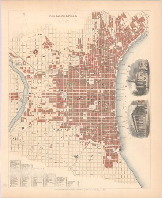
This is one of the best 19th century plans of Philadelphia. It shows the city center between the Schuylkill and Delaware rivers. There is extensive information on the streets, major buildings, parks, and landmarks. A list at bottom names 96 buildings and institutions. According to Melville Branch, this plan features "the most diverse identification" of all the cities covered in his book of SDUK city plans. In West Philadelphia, there are some canals that were constructed in 1833 to help coal barges travel down the Schuykill; these canals were later filled in as railroads became the preferred way to transport coal. Lovely engraved vignettes show the United States Bank and the Exchange.
References: Branch, pp. 102-103; Moreland & Bannister, p. 45.
Condition: B+
There is a hint of offsetting from an opposing page, minor extraneous creasing, and marginal toning.


