Catalog Archive
Auction 193, Lot 332
"West Indies, Agreeable to the Most Approved Maps and Charts", Kitchin, Thomas
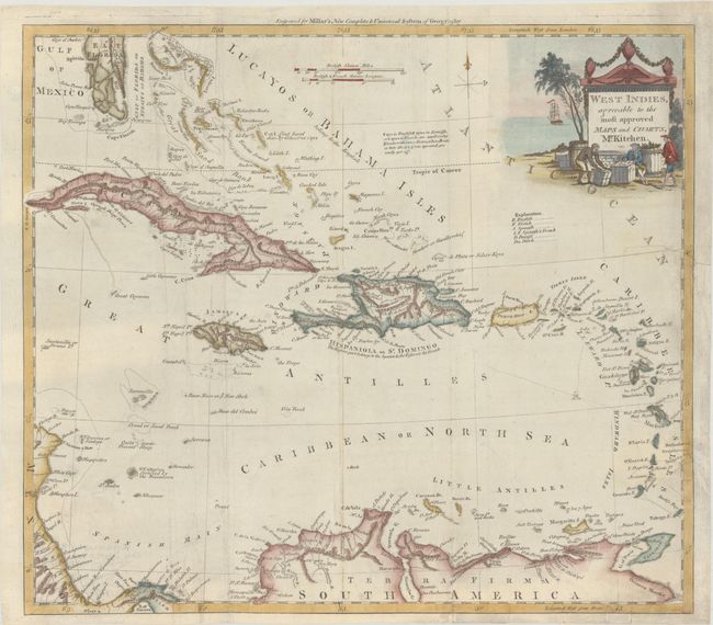
Subject: Caribbean
Period: 1782 (dated)
Publication: Millar's New Complete & Universal System of Geography
Color: Hand Color
Size:
15 x 13.3 inches
38.1 x 33.8 cm
Download High Resolution Image
(or just click on image to launch the Zoom viewer)
(or just click on image to launch the Zoom viewer)