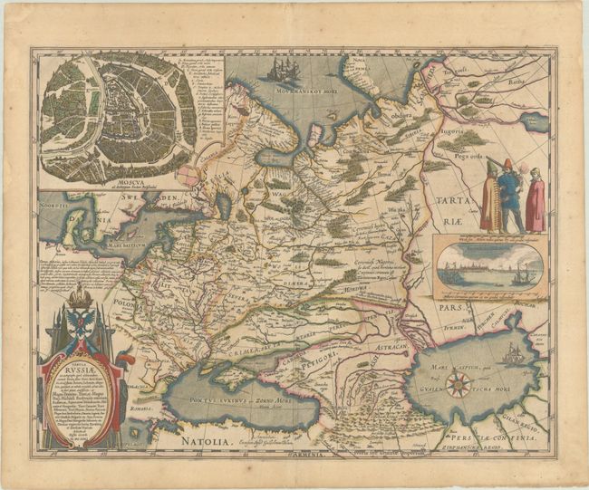
Subject: Russia in Europe
Period: 1644 (circa)
Publication:
Color: Hand Color
Size:
21.4 x 16.8 inches
54.4 x 42.7 cm
This is Blaeu's version of Hessel Gerritsz' rare and significant map of Russia, which he compiled from manuscripts brought back by Isaac Massa. The map covers the European part of the Russian Empire extending from Poland to the steppes of Tartary, and from the Mourmanskoy More (Barents Sea) to the Black and Caspian seas. The large inset plan of Moscow is attributed to the Crown Prince Fydor Gudonov. The map is richly decorated with a large title cartouche, sailing ships, a compass rose, three Russian gentlemen, and an inset view of Archangel Sckagoroda. Latin text on verso.
References: Van der Krogt (Vol. II) #1800:2.2.
Condition: B+
Full contemporary color on a lightly toned sheet with a few spots of foxing in the image, extraneous creasing along the centerfold, and remnants of framing tape along the edges of the sheet on verso.