Subject: Cartographic Miscellany, Low Countries
Period: 1622 (published)
Publication: Petri Kaerii Germania Inferior…
Color: Hand Color
Size:
17.9 x 14.6 inches
45.5 x 37.1 cm
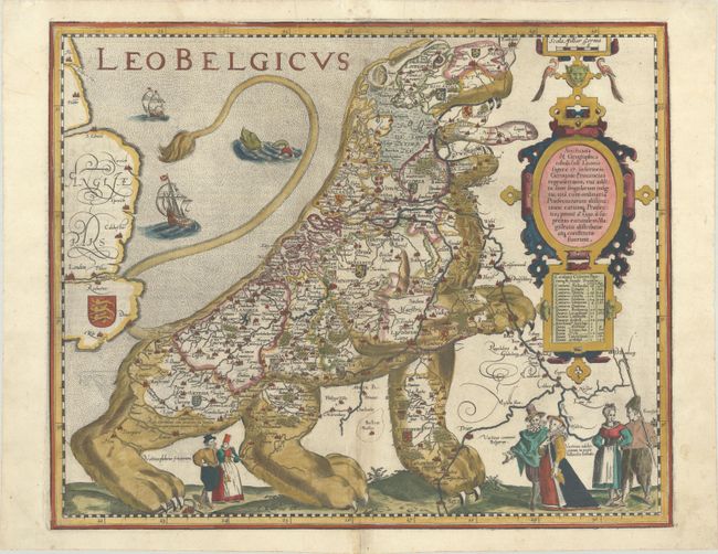
Among the most interesting decorative works of cartography is a series of arresting maps showing the Netherlands and Belgium in the shape of a lion. This wonderful folio version of the Leo Belgicus is based on the original 1583 Aitsinger form with the lion standing facing right with the right paw raised. At the time that Aitsinger developed the idea, Belgium and Holland comprised a single entity under the rule of the Spanish Empire. The concept was created in part due to the configuration of the land, and in part due to the appearance of a lion on the coat of arms of nearly every province in the region. Aitsinger's concept appealed to his contemporaries, and was redrawn and redesigned for over two centuries.
Van den Keere's version features an elaborate strapwork cartouche with a secondary title (Artificiosa & Geographica Tabula sub Leonis Figura 17, Inferioris Germaniae Provincias Repraesentans…), a distance scale, and a table of the provinces in the region. Three pairs of figures appear in the foreground at bottom, representing the typical costumes of Friesland, Belgium, and Holland. Additional embellishments include a stippled sea with two ships and a sea monster. Latin text on verso.
References: Tooley (MCC-7) #11; Map Collector Magazine, Issue 14, pp. 48-50.
Condition: A
Excellent impression on watermarked paper with several minor printer's creases at top left and expertly repaired centerfold separations that enter map 1/4" at top and 3" at bottom.


