Subject: Western Hemisphere - America
Period: 1700 (circa)
Publication:
Color: Hand Color
Size:
23.1 x 19.7 inches
58.7 x 50 cm
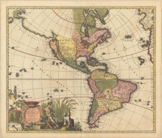
Sumptuous map of the Americas features a dramatically decorative title cartouche showing an Amazonian queen surrounded by riches, a sugar cane field and exotic animals. Inset in the cartouche is a small map of the coast of New Zealand. The cartography of North America includes all five Great Lakes and the island of California on the Foxe model with two indented bays on the northern coastline, and a string of spurious islands off the tip of California. Above California is a huge landmass labeled Terra Esonis that stretches nearly to Japan and Yedso. The Mississippi River is beginning to take shape with the R. Massourite (Missouri) making its appearance. Sanson's R. del Norte has been revised here so that there are two branches, one flowing correctly into the Gulf of Mexico and the other emptying into the sea between the mainland and the island of California (Mare Vermio cum Mare Rubrum). Interestingly the Apaches de Novajo region has moved considerably north where an unnamed river flows westward to the head of the Mare Vermio. In South America the mythical Lake Parime is no longer shown and the major river systems are beginning to take their proper shape. The Portuguese capitanias are delineated along the coast of Brazil. There are several islands shown in the Pacific including a coastline in the vicinity of Australia labeled Quiri Regio. This is the third state of the map according to Burden, with descriptions of the climates added to the side borders.
References: Burden #724; McLaughlin #132; Tooley (Amer) p.127 #65.
Condition: B+
A sharp impression with full contemporary color on a bright sheet with two small worm holes in the image and some cracks caused by the oxidation of the green pigment that have been closed on verso with archival materials.


