Subject: Colonial North America
Period: 1780 (circa)
Publication:
Color: Black & White
Size:
7.9 x 5.8 inches
20.1 x 14.7 cm
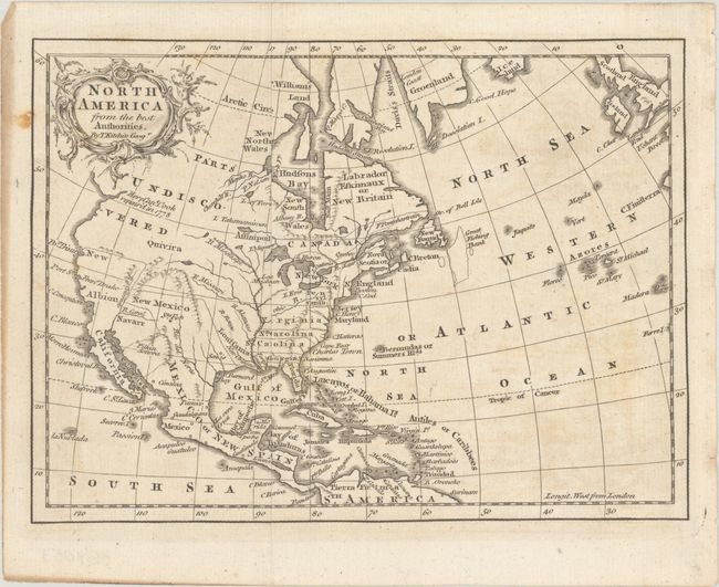
This small map of the continent shows the southern colonies of Virginia, North Carolina, South Carolina, and Georgia all extending to the Mississippi River. Spain is in control of the region to the west of the Mississippi River with only a few place names located including Senis in present-day Texas and Santa Fe. The Pacific Northwest is "Parts Undiscovered" with a note along the coast stating "Here Capt. Cook repair'd in 1778." Cook made these noted repairs to the Endeavor in Prince William Sound, Alaska, but Kitchin locates the Sound too far to the south. The map extends through Central America to northern South America with good detail of the West Indies. Ireland and Britain are located along the top right border. Adorned by a strapwork title cartouche.
References:
Condition: B+
Issued folding with faint offsetting and a few spots of foxing.


