Catalog Archive
Auction 194, Lot 178
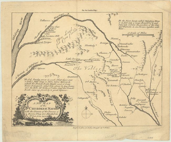
One of the Earliest Printed Maps of Western North Carolina
"A New Map of the Cherokee Nation with the Names of the Towns & Rivers, They Are Situated on No. Lat. from 34 to 36", Kitchin, Thomas
Subject: Colonial Southeastern United States
Period: 1760 (published)
Publication: London Magazine
Color: Black & White
Size:
8.8 x 6.6 inches
22.4 x 16.8 cm
Download High Resolution Image
(or just click on image to launch the Zoom viewer)
(or just click on image to launch the Zoom viewer)