Subject: Southern United States
Period: 1911 (dated)
Publication:
Color: Printed Color
Size:
23.2 x 35.1 inches
58.9 x 89.2 cm
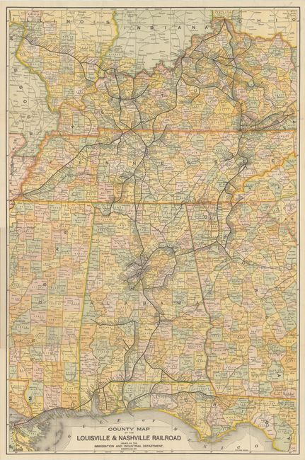
An attractive and detailed map covering Tennessee, Kentucky, Alabama and parts of Georgia, Florida and Mississippi. It is delineated by county and shows the extent of the company’s railroad lines that go far beyond its namesake, extending from Cincinnati and St. Louis down to Pensacola and New Orleans. Published by the L&N Railroad’s Immigration and Industrial Department in an effort to promote settlement in the regions it served. Folds into its original mailed wrappers with 1912 postmark.
References:
Condition: A
The map is very clean and bright with a couple of short splits at the fold junctions. Paper wrappers are lightly soiled and worn.


