Subject: Shelter Island, New York
Period: 1966 (dated)
Publication:
Color: Printed Color
Size:
26.9 x 19.5 inches
68.3 x 49.5 cm
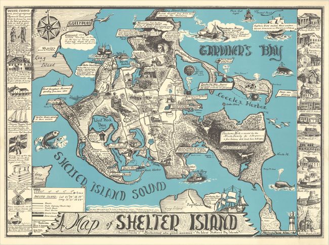
This rare pictorial map was designed by Shelter Island local Edith H. Shepherd in a pen-and-ink style that feels both folksy and refined. It shows the island town, located at the eastern end of Long Island, in between Shelter Island Sound and Gardiner's Bay. The island is covered in historical notes and images of farmland and local attractions. The Mashomack Forest is a dense, inky thicket with a deer head and fox emerging from the shadows. Ferries, yachts, lighthouses, a whale, Captain Kidd's ship, and various other vessels fill the waters. At left are a series of historical vignettes, and at right are illustrations of local institutions and ferries. A compass rose in the top left corner completes the composition. Originally printed in 1950, this is the revised edition published in 1966.
References:
Condition: A+
Fine.