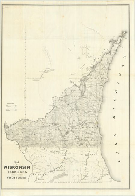
Subject: Wisconsin
Period: 1839 (published)
Publication: Sen. Doc. 140, 26th Congress, 1st Session
Color: Black & White
Size:
24.3 x 34.8 inches
61.7 x 88.4 cm
This uncommon and early map of Wisconsin extends from the surveyed part between the Illinois border and the Wisconsin River north to show all of the Door Peninsula. It was compiled from the surveys of Capt. Thomas Jefferson Cram and accompanied his "Report from the Secretary of War…[concerning] the internal improvements in the Territory of Wisconsin…" It is notable for delineating the “Boundary Line of the Fifth State Established by the 5th Article of the Ordinance of Congress of 1787,” which would have placed Chicago in Wisconsin. Streeter highlights this boundary error and notes that “The southern boundary of ‘the fifth state’ actually was fixed further north when Illinois was made a state in 1816.” A large, early and desirable map for any Wisconsin, Illinois or Chicago collector. Lithography by W. Stone.
References: Claussen & Friis #329; Streeter (Sale) #1934.
Condition: B+
Issued folding on a bright sheet with a few spots of foxing and minor extraneous creasing.


