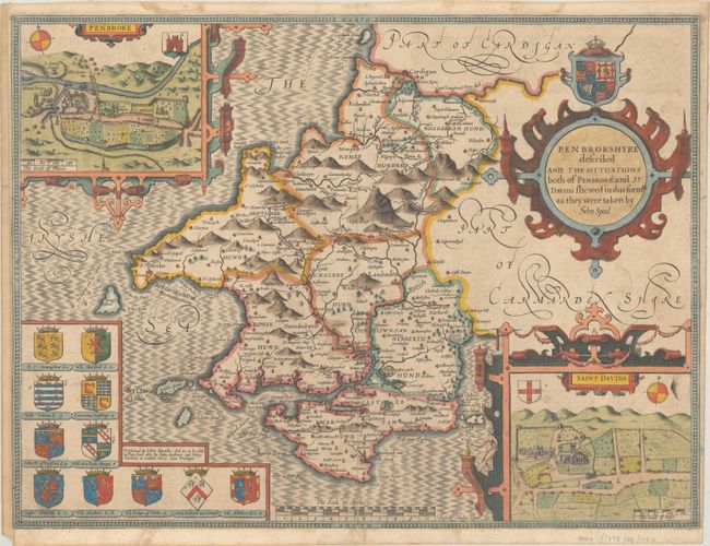
Subject: Southwestern Wales
Period: 1610 (dated)
Publication: The Theatre of the Empire of Great Britaine…
Color: Hand Color
Size:
20.1 x 15 inches
51.1 x 38.1 cm
This superb map of the county of Pembrokeshire features two large strapwork cartouches with inset maps of Pembroke and St. Davids. The map divides the county into hundreds and depicts numerous towns and villages. The Preseli Mountains are graphically depicted. The map is adorned with the coats of arms of a number of important figures of the region, including the Prince of Wales. Engraved by Jodocus Hondius and sold by John Sudbury and George Humble circa 1614.
References: Shirley (BL Atlases) T.SPE-1b.
Condition: B+
A nice impression on a sheet with a small coat of arms watermark, light soiling, and old paper repairs to a centerfold separation and short tear at bottom. Remargined at left and bottom with a narrow right margin and a few tiny chips and tears along the edges of the sheet.


