Subject: Spain & Portugal
Period: 1957 (circa)
Publication:
Color: Printed Color
Size:
41.3 x 29.6 inches
104.9 x 75.2 cm
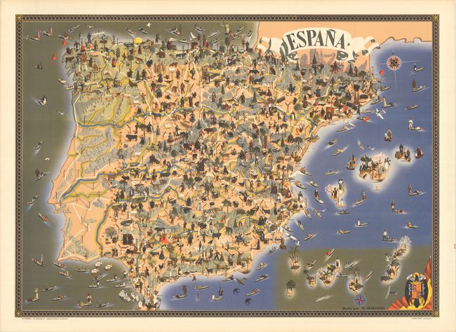
This superb pictorial map of Spain was created by M. Heredero. The map shows the history, culture, and natural resources in Spain, as well as the modes of telecommunication and transportation. The map is densely filled with tiny images of all of the types of products produced in each region, historical figures and costumes, famous landmarks, and three-dimensional representations of the mountains. Single black lines criss-cross the country to show the lines of telecommunication, double-black lines show the railroad routes, and white lines show the roads. Small boats fill the surrounding waters carrying imports and exports, represented by each country's flag. The boundary between Spain and Portugal is denoted with tiny Spanish and Portuguese flags, and the lines representing telecommunication, railroads, and roads are also shown within Portugal. Francoist Spain's coat of arms is included at bottom right, with the motto "Una Grande Libre" (One, Great and Free). Printed by Talleres Offset and published by La Normal.
References: Rumsey #10670.
Condition: A+
A crisp, clean example with just a hint of toning along the edges of the sheet.


