Subject: North America
Period: 1936 (dated)
Publication:
Color: Printed Color
Size:
30.8 x 25.8 inches
78.2 x 65.5 cm
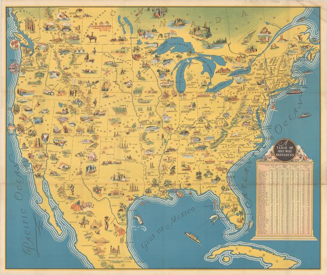
This full-color pictorial map of North America is filled with charming vignettes and figures. Both tourist destinations and local resources are highlighted including Yellowstone, Yosemite, Grand Canyon, and the Alamo, to name a few. A large table of distances from New York, Boston, Montreal, and Norfolk to points west fills the Atlantic Ocean. Self-folding (4.0 x 9.0") with an illustrated cover. Verso features black & white photographs and English text aimed at the railroad traveler (the map was issued by the "Railroads of the United States Canada and Mexico"). Another edition was published with French text as well. Printed by the Poole Brothers in Chicago.
References:
Condition: A
A clean, bright example, issued folding, with minor extraneous creasing and light soiling in the top right corner.


