Subject: Washington, D.C.
Period: 1894 (published)
Publication: Sen. Report No. 623, 53rd Congress, 2nd Session
Color: Printed Color
Size:
27.2 x 28.2 inches
69.1 x 71.6 cm
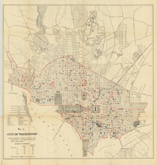
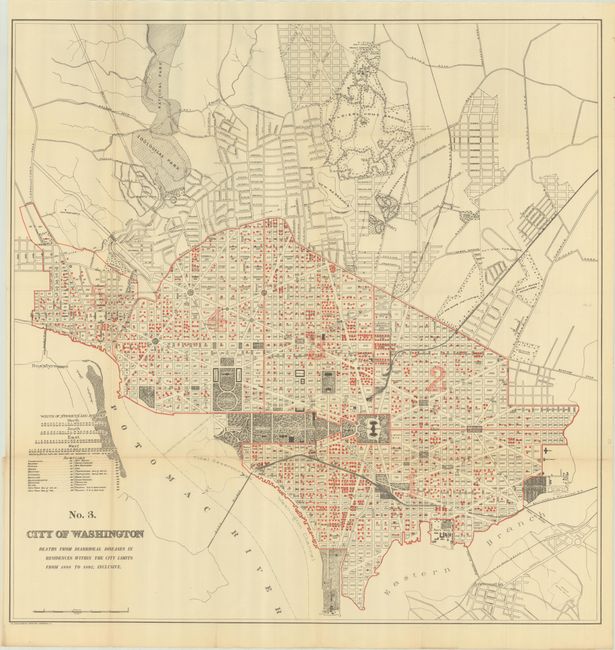
These five thematic maps appeared in a Congressional report concerning improvements and extensions to the sewage system in the District of Columbia. Beginning in the early 1870's, population growth exploded and the city lacked the basic infrastructure to support it. In 1874, Congress created a three-person Board of Commissioners to become the permanent government for the District. Over the next several decades, much was done by the Commission to improve living conditions and infrastructure including paved roads, new water lines, and upgraded sewer capacity. These maps reflect the progress of those efforts.
Each map begins "Map of the City of Washington..." and examines deaths as a result of unsanitary conditions, box privies (self-contained toilets), water pumps, and more. In addition to some rather grim statistics, each map presents fine detail along the Mall and the beginning subdivisions in the open spaces to the north. Each uses the same base map. Lithographed by Norris-Peters Company in Washington. Accompanied by the disbound 37-page report.
References:
Condition: B+
Issued folding on clean sheets with a hint of light toning, a number of short splits at the fold junctions, and several small fold separations that have been closed on verso with archival tape. The first 10 pages and last 4 pages of the disbound report are loose.


