Subject: World
Period: 1665 (circa)
Publication:
Color: Hand Color
Size:
19.9 x 11.8 inches
50.5 x 30 cm
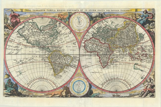
This rare double-hemisphere world map follows the cartography of Paulus Merula's 1605 world map but the decorative surround from Nicholas Visscher's 1663 world map. Dancker Danckerts, son of Cornelis Danckerts, copied the cartography of the northern hemisphere from Merula's map, which itself was a copy of Petrus Plancius' 1590 map, but made significant updates in the southern hemisphere. Notably, the large southern continent was omitted, as was an oversized New Guinea and the Solomon Islands. In their place, Danckerts added partial coastlines of Australia, Tasmania, and New Zealand based on recent Dutch explorations. In addition, Tierra del Fuego is depicted as an island and newly discovered islands in the south Pacific have been added. The map is surrounded by engravings copied from Visscher, including allegorical representations of the continents as well as native inhabitants and wildlife. Two diagrams depicting the Ptolemaic and Copernican theories of the solar system appear within the cusps of the hemispheres. Dutch text on verso.
The Danckerts family competed with the Visscher firm in producing maps for Dutch bibles, but as Visscher's work was more popular at the time, Danckerts' maps are not often found on the market. We have only found 2 other examples of this map for sale in the last 30 years.
References: Poortman & Augusteijn #100; Shirley #432(B).
Condition: B+
A dark impression, issued folding on a bright sheet, now flattened and professionally backed with thin, archival tissue to repair some separations along the folds and adjacent tears (primarily within the Ptolemaic diagram at bottom), as well as some chips and tears along the edges of the sheet.


