Catalog Archive
Auction 195, Lot 513
"Arena Martis in Belgio, qua Provinciae X. Catholicae Inferioris Germaniae cum Vicinis Episcopatibus, Coloniensi et Leodiensi...", Homann, Johann Baptist
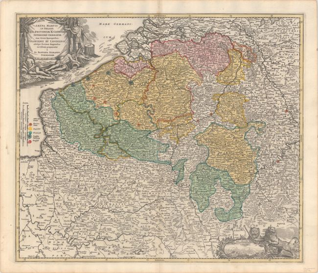
Subject: Low Countries
Period: 1716 (circa)
Publication: Grosser Atlas
Color: Hand Color
Size:
22.3 x 19.2 inches
56.6 x 48.8 cm
Download High Resolution Image
(or just click on image to launch the Zoom viewer)
(or just click on image to launch the Zoom viewer)