Subject: Pacific Ocean, World War II
Period: 1938 (published)
Publication: Fortune Magazine
Color: Printed Color
Size:
21.9 x 13.4 inches
55.6 x 34 cm
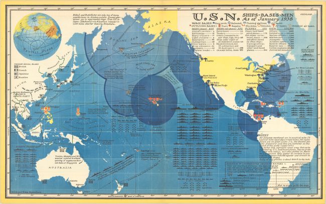
This detailed map, centered on the Pacific Ocean, demonstrates the strength of the U.S. Navy on the cusp of World War II. Along the U.S. coastline, Navy yards, air bases, training stations, and points of defense are located. Outlying bases are identified by small red circles, and indicate capabilities including refueling and the ability to make repairs. The composition of various U.S. fleets are shown in the oceans, while large blue circles indicate "areas that can be patrolled by U.S. land-based planes." Across the Pacific, various foreign naval bases are identified by small flags including those of the British, French, Japanese and Russians. Various notations fill the Pacific including "Most likely area for naval action" and "The 'Fence' U.S. Navy matches the Japanese in politeness by maneuvering only on its side of this line." This fascinating and information-packed map was published in the March 1938 edition of Fortune Magazine.
References:
Condition: A
A colorful example on a clean sheet. The centerfold has been reinforced on verso with archival tissue.


