Subject: Colonial North America
Period: 1693 (dated)
Publication:
Color: Hand Color
Size:
11.1 x 8 inches
28.2 x 20.3 cm
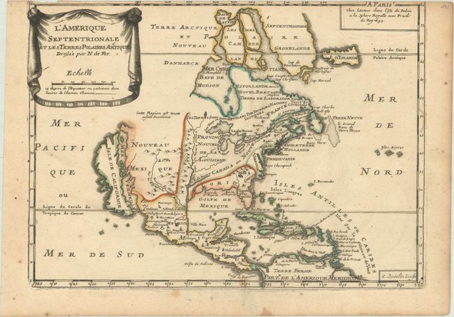
This uncommon map is based on Coronelli's large, two-sheet depiction of the continent from 1692. California is depicted as an island on the second Sanson model with two indented bays in the northern coast. De Fer's map deviates from Coronelli's cartography in a couple of regions; Lake Ontario forms the headwaters of the St. Lawrence River leaving the other Great Lakes landlocked, and Baffin Island is shown. The map is small, and thus not heavily detailed, but the eastern coast includes the names of Boston, New York, Providence, Chesapeake Bay, Virginia, Carolina, and Florida. The title is displayed on a drape-style cartouche. This is the first state of the map, engraved by C. Inseln.
References: Burden #696; McLaughlin #111.
Condition: B
An early impression with contemporary outline color on a lightly toned sheet. There are a few spots of foxing, several small stains, and the top neatline has been trimmed from the sheet by the bookbinder.