Subject: Alaska
Period: 1958 (dated)
Publication:
Color: Black & White
Size:
27 x 20.1 inches
68.6 x 51.1 cm
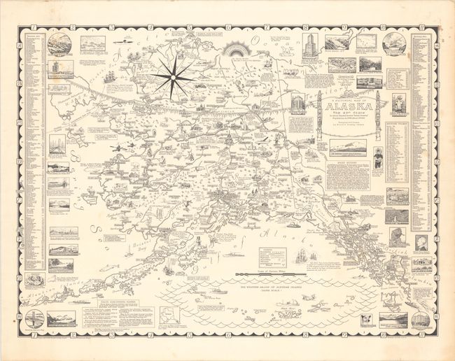
This decorative and informative pictorial map of Alaska has a copyright date of 1958, just before the state was officially admitted to the Union. It is packed with illustrations showcasing the state's history, landscapes, wildlife, and culture. Among the illustrations are the aurora borealis; an Inuit child thrown into the air from a walrus blanket; a portrait of William Henry Seward ("He bought the 'Ice Box!'"); Captain Cook surveying the Alaskan coast; Vitus Bering sailing the strait that now bears his name; a Kodiak bear; reindeer; and much more. A small map at bottom demonstrates the comparative sizes of Alaska and Texas. Towns and cities can be located with the help of tables at left and right, and the legend identifies boundaries, rivers, railroads, highways, mountains, volcanoes, and scheduled air service places. An inset at bottom shows the western group of the Aleutian Islands. Text boxes relate facts about the state. The title cartouche is flanked by two totem poles and notes that the state's population is 215,000. This is the first edition of the map, with later color issues in 1959 and 1965. Designed and drawn by Ernest Dudley Chase (1878-1966), one of the leading figures in pictorial mapmaking during the middle 20th century.
References: Hornsby (Picturing America) pp. 31-34; Rumsey #7958.
Condition: B+
There are small light stains at left and right and marginal toning at right.


