Subject: Southern California & Bay Area
Period: 1920-55 (dated)
Publication:
Color: Printed Color
This lot features three fascinating maps detailing water and energy in Southern California and the Bay Area:
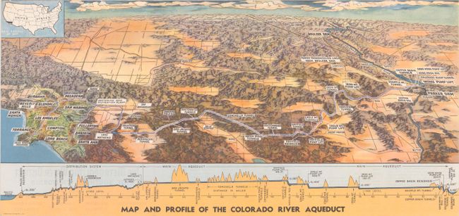
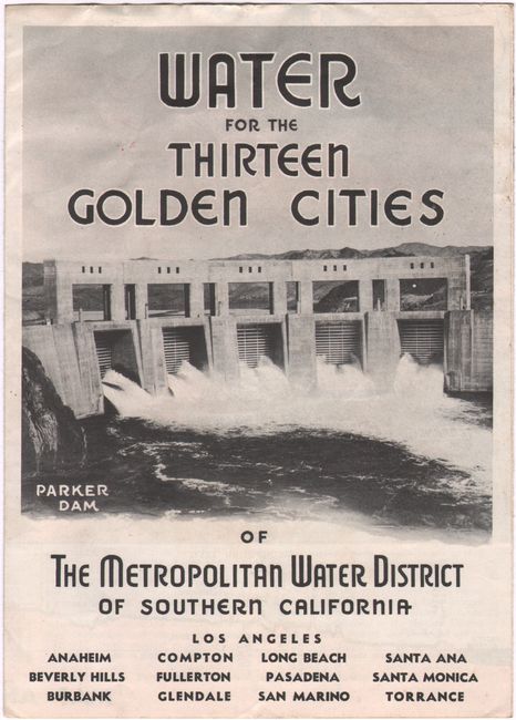
A. Map and Profile of the Colorado River Aqueduct, by the Metropolitan Water District of Southern California, dated 1941 (19.6 x 9.3"). This detailed panoramic view issued by the Metropolitan Water District of Southern California presents the topography of the region from Boulder Dam and the Colorado River west to Los Angeles. It highlights the path of the Colorado River aqueduct and locates various dams, tunnels, pump lifts, reservoirs, and more. A profile at bottom visually depicts the challenge of constructing an aqueduct through such a rugged region. Completed in 1941, it runs 242 miles across the Mojave and Colorado deserts and is a major source of water to Southern California. In 1955, it was designated one of the seven wonders of American engineering by the American Society of Civil Engineers. Self-folding (6.6 x 9.1") with title "Water for the Thirteen Golden Cities of the Metropolitan Water District of Southern California." Condition: Issued folding with minor extraneous creasing along the top edge. (A)
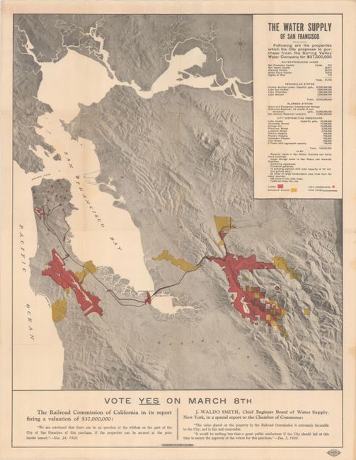
B. The Water Supply of San Francisco, by Halprin Lithograph Company, dated 1920 (15.7 x 20.5"). This rare and interesting map of the Bay Area depicts the areas the city of San Francisco proposed to purchase from the Spring Valley Water Company for $37 million in 1921. Water-producing lands are shown in red; riparian rights are shaded yellow; city reservoirs are indicated by a red dot; and pipelines are delineated by bold lines. Text below the map attempts to persuade voters to approve the deal, thus securing water for the growing city. A majority voted yes on March 8th, 1921, but it was not the two-thirds majority required. The purchase was eventually approved in 1928. Condition: Issued folding with short splits at a few fold intersections and minor toning. (B+)
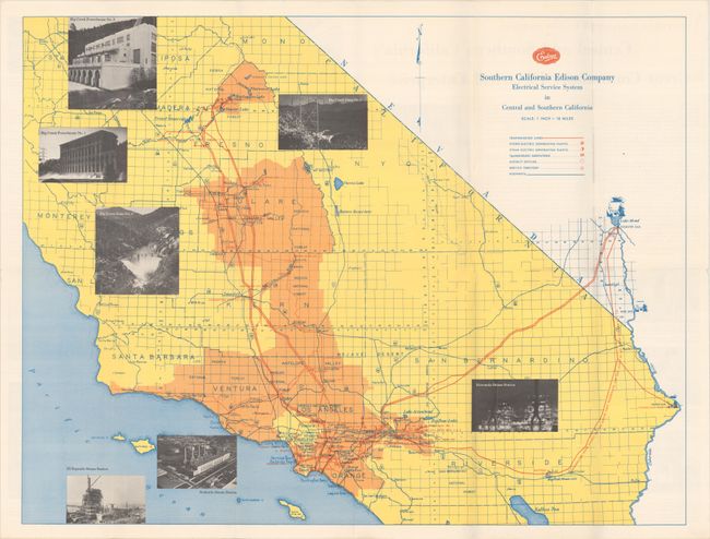
C. Southern California Edison Company Electrical Service System in Central and Southern California, by Edison Company, dated 1955 (23.2 x 17.8"). This map was published by Southern California Edison Company, the primary provider of electricity for Southern California. The map spans from the Salton Sea north to Mariposa. The region is laid out on a grid with towns and cities, counties, national forests, lakes, and reservoirs located. A key below the title identifies transmission lines, hydro-electric generating plants, steam electric generating plants, transmission substations, district offices, service territories, and highways. Self-folding (4.3 x 9.5") with the alternate title "Pictorial Map and History of the Southern California Edison Company." Condition: A colorful example, issued folding. (A+)
References:
Condition:
See description above.


