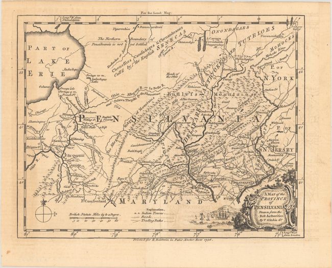
Subject: Colonial Pennsylvania
Period: 1756 (dated)
Publication: London Magazine
Color: Black & White
Size:
8.6 x 6.7 inches
21.8 x 17 cm
A nice example of this uncommon Colonial Pennsylvania map. This is the first map of Pennsylvania by itself, rather than the Philadelphia or Mid-Atlantic regions. It pre-dates the larger and better known 1759 Scull map by three years. The map is very crisply detailed with roads, portages, forts, towns and villages, watershed, and mountains. A surprising number of roads run between Philadelphia and the towns in the southeast portion of the colony, running all the way to Fort Cumberland in Maryland. In the western frontier there are several Indian tribes and villages located, as well as several settlements including Petroleum, Wenang, Fort du Quesne, and more. It is based on the 1749 Evans map and incorporates the 1732 boundary accord of Lord Baltimore and the Penns, which set the boundary at essentially its present position. The boundary with New York is placed at about 42° 30' and is labeled "not yet settled." The western boundary is a mirror image of the eastern and is placed just west of Fort du Quesne. The map is very up-to-date with the Ohiopyle Falls on the Youghiogheney River identified. As was the practice of the day, longitude from Philadelphia is noted at top, from London at the bottom. Legend identifies Indian Towns, Roads, and Trading Paths. Decorative title cartouche features ships at anchor. The map was printed for R. Baldwin in Pater Noster Row, and appeared in the December 1756 issue of the London Magazine.
References: Jolly #LOND-112; Phillips (Maps) p. 673; Sellers & Van Ee #711.
Condition: B+
Issued folding with light toning and offsetting.


