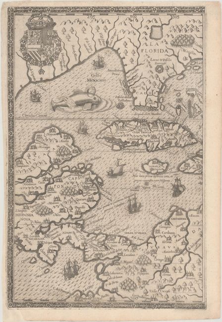
Subject: Gulf of Mexico & Caribbean, Florida
Period: 1594 (circa)
Publication: Grands Voyages, Part IV
Color: Black & White
Size:
8.6 x 13.1 inches
21.8 x 33.3 cm
This copper engraving is from a remarkable series of publications, illustrating voyages of discovery and travels of exploration to various parts of the world. The project was begun by Theodore de Bry of Frankfurt, in 1590 and was to continue for another 54 years. They became known collectively as the Grands Voyages (to America and the West Indies) and the Petits Voyages (to the Orient and the East Indies). De Bry died after the first six parts of the Grands Voyages were completed. The project was completed initially by his widow and two sons, Johann Theodore de Bry and Johann Israel de Bry, then by his son-in-law, Matthaus Merian in 1644.
This is the western half of this spectacular map that illustrates the region traveled by Girolamo Benzoni between the years 1541 and 1556. The map provides an early delineation of Florida derived from Le Moyne and is one of the earliest maps to detail northern South America, on this sheet stretching from Cartagena to Guayaquil, here called S. tiago. A large Cuba is at the center of this half of the map. A note off the coast of Honduras marks Columbus' fourth and final voyage. De Bry's extraordinary engraving skill and artful style are very evident with the ornate coat of arms at top left, a massive sea monster, sailing galleons, and the intricate border.
References: Burden #83; Potter p.164.
Condition: B+
On watermarked paper with a few printer's creases and a couple light spots. The sheet has been professionally remargined at right with the border at right in facsimile.


