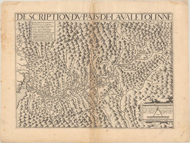
Subject: Northern Italy
Period: 1643 (dated)
Publication: Theatres des Gaules
Color: Black & White
Size:
18.5 x 13.6 inches
47 x 34.5 cm
This scarce map focuses on the Adda River valley, extending east from Lake Como and including the Oglio River at right. The map is graphically engraved with mountains and filled with place names. A lettered key at top left identifies several locations on the map. The directions on the map erroneously indicate that north is to the right, however north is actually positioned at the top of the map, as this portion of the Adda River flows to the west.
References: Pastoureau, BOISSEAU II [47].
Condition: B
A sharp impression with toning along the centerfold, a bit of extraneous creasing, marginal foxing, and a centerfold separation at top that has been closed on verso with old paper. There is a short tear in the bottom margin, well away from the image.


