Subject: New Zealand
Period: 1967 (dated)
Publication:
Color: Printed Color
Size:
28.9 x 37.3 inches
73.4 x 94.7 cm
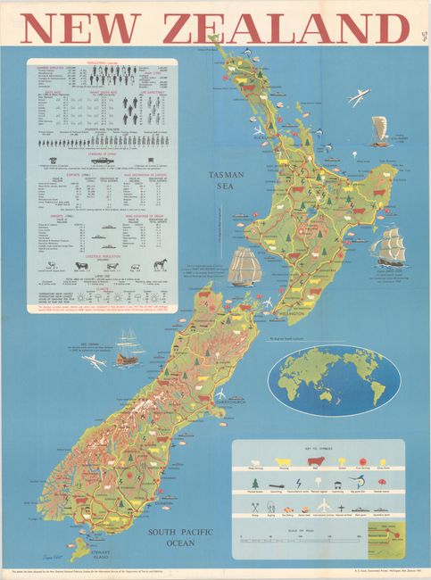
This large decorative pictorial map of New Zealand was designed by the New Zealand National Publicity Studios for the Information Service of the Department of Tourist and Publicity. The map depicts the islands in bold, vibrant graphic form, credited to artist Eugene Collott. A key at bottom right identifies the various symbols, including sheep farming, dairying and beef cattle, fruit farming, thermal regions, planted forests, big game fish, seaside resorts, oyster beds, airlines, ports, highways, and more. In the surrounding ocean are a couple airplanes and the sailing vessels of the Maori, Abel Tasman, Captain James Cook, and the first organized group of British colonists. An inset situates New Zealand in the broader context of a world map. At top left, a large table features statistics on population, standard of living, exports, climate, and more. Printed by R.E. Owen, Government Printer in Wellington.
References:
Condition: A
A colorful example, issued folding, with minor extraneous creasing near the folds. Old stamp on verso.


