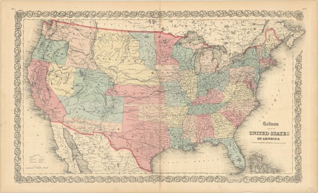
Subject: United States
Period: 1855 (dated)
Publication:
Color: Hand Color
Size:
26.5 x 15.9 inches
67.3 x 40.4 cm
This scarce map of the United States is from the rare Colton atlas that was published by Johnson and Browning, circa 1859. It is filled with a number of transitional western territorial boundaries including Washington in the inverted "L" shape incorporating present-day Idaho, a large Nebraska Territory situated between the Rocky Mountains and Missouri River, and a small wedge of Dakota Territory between the Missouri River and Red River. Utah is shown in its largest extent, though the western portion of the territory indicates the proposed state of Nevada in smaller font and with different coloring. The proposed Arizona Territory is shown in the southern part of New Mexico, and Kanzas Territory borders Utah and New Mexico in the west. The map shows good detail of watersheds, topography, forts, Indian tribes, emigrant roads, and exploration routes including those of Fremont, Marcy, and Kearney.
References:
Condition: B+
Contemporary color with light toning along the centerfold and minor foxing.


