Subject: United States
Period: 1872 (dated)
Publication: Statistical Atlas of the United States…Ninth Census, 1870
Color: Printed Color
Size:
33.5 x 21.6 inches
85.1 x 54.9 cm
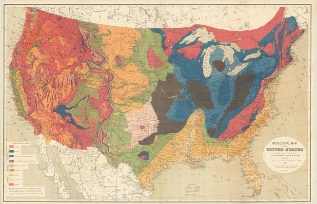
This large and very colorful thematic map is the first edition that, according to Marcou & Marcou, was dated 1874 but some "copies dated 1872…were privately distributed." This is one of those scarce examples. It identifies railroads, roads, canals, army arsenals, forts and much more. A table at lower left provides an explanatory key to the colors used to indicate nine distinct geological types. The carefully drawn map presents a wonderful comingling of both geographical and geological detail. The base data is from the War Department's "Military Map of the United States," used by permission of the Chief of Engineers. A seldom seen version of Hitchcock's standard map.
References: Marcou & Marcou #70; Phillips (A) #1330.
Condition: B+
A colorful example, issued folding, with some minor foxing mostly along the left and right borders. A few tiny fold separations have been closed on verso.


