Subject: World
Period: 1781 (dated)
Publication: Atlas Portatif
Color: Hand Color
Size:
13 x 8.6 inches
33 x 21.8 cm
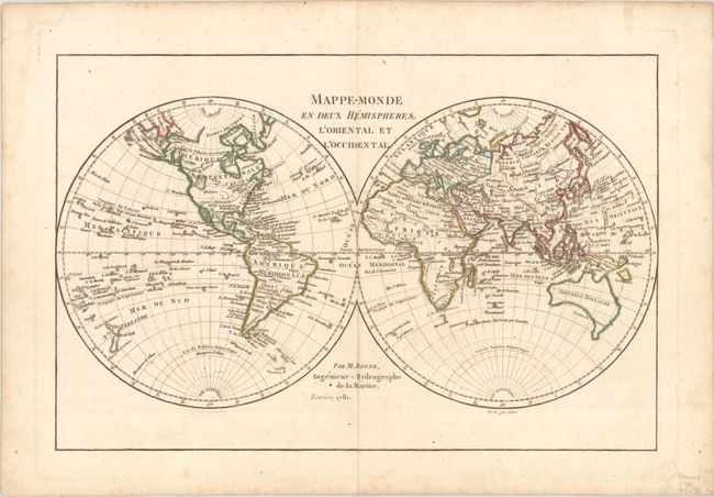
This attractive double-hemisphere world map depicts Greenland and the Arctic attached to North America. The Pacific Northwest is distinguished by the huge Sea of the West and a Northwest Passage connects Hudson Bay with the Pacific through a network of rivers and lakes. The United States is named and confined along the eastern seaboard, and the entire western region is blank with the only place name being C. Mendocino. Alaska has a rudimentary form and the Sandwich Islands are located. Tasmania is attached to Australia and both islands of New Zealand are depicted. Drawn by Andre and engraved by Perrier.
References: McGuirk #179.
Condition: A
Contemporary outline color with marginal soiling and foxing.


