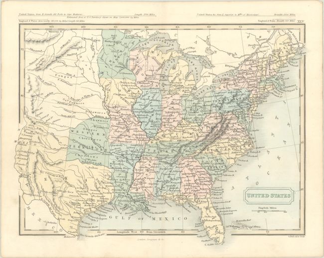
Subject: Eastern United States
Period: 1849 (circa)
Publication:
Color: Hand Color
Size:
10.4 x 8.1 inches
26.4 x 20.6 cm
This handsome small map of the United States extends as far west as New Mexico. There is a Western Territory north of Texas that extends to the Kansas River, where Shawnees, Wyandots, Osages, Cherokees, Creeks, and Choctaws reside. Much of the western portion consists of tribal lands. There are plenty of place names in Texas, including Austin, S. Antonio de Bexar, Houston, Galveston, Laredo, and El Paso del Norte. Minnesota Territory, established in 1849, is shown in the north. Above the map are mileage comparisons between England and Wales and the United States. Published by Longman & Co.
References:
Condition: A
Near fine, with a hint of soiling in the left blank margin.


