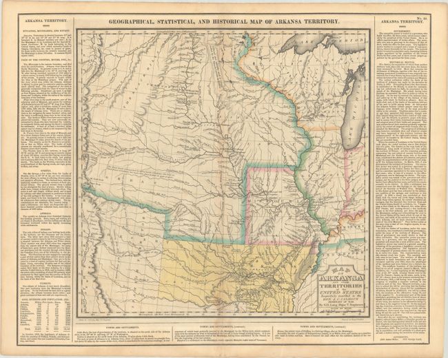
Subject: Central United States, Arkansas Territory
Period: 1827 (published)
Publication: A Complete Historical, Chronological, and Geographical American Atlas...
Color: Hand Color
Size:
20.6 x 16.5 inches
52.3 x 41.9 cm
For this commercial atlas version of the Stephen Long report map, Carey & Lea chose a single sheet format at a reduced scale with the political boundaries highlighted in color. Extraneous details, including Major Long's astronomical notations, camp site locations, and elevation profile were eliminated, and information about Arkansas and surrounding territories was added in columns of text framing the map at the sides. The geological details were retained thus qualifying the map for an affordable alternative to Long's report-version map. Minor variations in place names, landform engravings, and lettering between the atlas and Long's map exist, with the most obvious being "Great Desert" substituted from Long's famous "Great American Desert" found on his report map. Other interesting differences exist, such as "Pawnee villages deserted in 1810," whereas the Long map uses the date of 1820. The Long expedition ranks with the expeditions of Lewis & Clark and Zebulon Pike in important explorations of the Trans-Mississippi West.
This is the second state of the Carey & Lea edition, published in 1827, with minor variations in the surrounding text (note that it identifies George Izard as the governor of the territory in 1825). Claims are sometimes made that the first edition (1822) Carey & Lea map preceded the publication of the Long report map based on a date of 1823 for the report. However, both were actually published in 1822, making the distinction impossible to tell from date alone. Even Wheat erroneously assigns an 1823 date to the Long report map. An interesting question that deserves further study. The map itself measures 14.7 x 14.5". Drawn by Stephen Long and engraved by Young & Delleker.
References: Phillips (Atlases) #1177-35; Wheat (TMW) #348.
Condition: B+
Full contemporary color on a sheet with light toning along the centerfold and minor offsetting. There are two light dampstains at bottom.


