Subject: Central United States
Period: 1875 (circa)
Publication:
Color: Hand Color
Size:
38.3 x 27.3 inches
97.3 x 69.3 cm
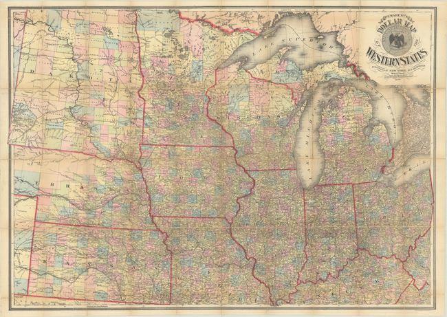
This rare pocket map of the Midwest and beyond extends from Michigan, Ohio and Kentucky west to the Dakotas, Nebraska and Kansas. Counties are delineated in attractive hand-coloring and there is excellent detail of cities and town, watersheds, and the railroad network. The large Dakota Territory is almost entirely divided into counties, while the western third of Nebraska is unorganized. A large Indian Reservation in northwestern Dakota is identified for the Gros Ventre and Mandan Indians, and directly to its north is a large Military Reservation along the Missouri River containing both Fort Union and Fort Buford. Decorated by a title cartouche featuring the United States Seal and fancy lettering. Lithographed by Neuman & Dinglinger in New York. Covers not present. We found no past sales records for this map in the last 40 years and no institutional examples on OCLC or elsewhere.
References:
Condition: B
Issued folding with numerous fold separations and a few edge tears that have all been closed on verso with old tape. Covers not present.