Subject: Louisiana
Period: 1881 (dated)
Publication:
Color: Black & White
Size:
27.5 x 37.8 inches
69.9 x 96 cm
The Office of Coast Survey is the oldest U.S. scientific organization, dating from 1807 when Congress directed that a "survey of the coast" be carried out. By 1836, it was called the U.S. Coast Survey and in 1878, the name was changed to the U.S. Coast and Geodetic Survey. Today the Office of Coast Survey is a division of the National Oceanic and Atmospheric Administration NOAA.
The survey teams, composed of civilians as well as Army and Naval officers, charted the nation's waterways and produced a wide array of reports, survey charts, hydrographic studies of tides and currents, astronomical studies and observations, and coastal pilots. These charts are an important record of the changing nature of the nation's coastlines. In additional to coastal charts, the U.S. Coast and Geodetic Survey produced land sketches, Civil War battle maps, and the early aeronautical charts.
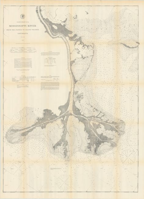
An attractive and highly detailed chart depicting the mouth of the Mississippi River from above Fort Jackson to the Gulf of Mexico. There is outstanding detail in the river and bays including numerous soundings, ground types, lighthouses, buoys, magnetic variation and more. Surveys for this chart were made between 1857-72 under the direction of A.D. Bache and Benjamin Pierce. It was first published in 1874 and updated here in 1881.
References:
Condition: A
Issued folding with faint toning along the fold lines, some tiny splits at the fold junctions, and a short repaired binding tear confined to the upper left blank margin. The toning in the image appears more prominent than what is on the actual physical map.