Subject: Martha's Vineyard, Massachusetts
Period: 1873 (dated)
Publication:
Color: Black & White
Size:
34.1 x 25.8 inches
86.6 x 65.5 cm
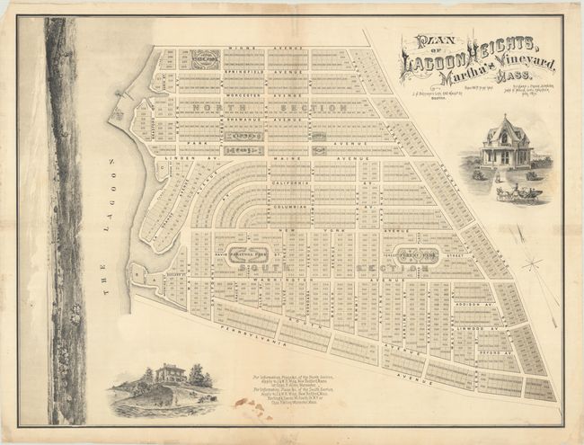
This promotional real estate map for Lagoon Heights was surveyed by Richard Pease and lithographed by J.H. Bufford in Boston. It presents the street-grid pattern of the development, which is divided into a north and south section and further subdivided into 949 lots with four integrated green spaces. The plan is attractively decorated by illustrations of two Victorian cottages and a sweeping headland view along the left border.
“Lagoon Heights” was located on the north end of Martha's Vineyard in the area now called Oak Bluffs. At the time of publication, this land was still part of Edgartown, but was renamed Cottage City in 1880 due to the development taking place. In 1907, the town was renamed Oak Bluffs, and today it is one of the island’s principal ports for summer tourism and is well known for its very colorful “gingerbread cottages,” hundreds of which still stand today.
References: Rumsey #5306.
Condition: B
Issued folding on thin paper with an archivally repaired 3.5" tear at lower right and some minor staining at bottom. Several small fold separations and tiny edge tears have been repaired with old tape on verso, with some related minor staining visible on recto.