Subject: Washington
Period: 1866 (dated)
Publication:
Color: Hand Color
Size:
30.7 x 23 inches
78 x 58.4 cm
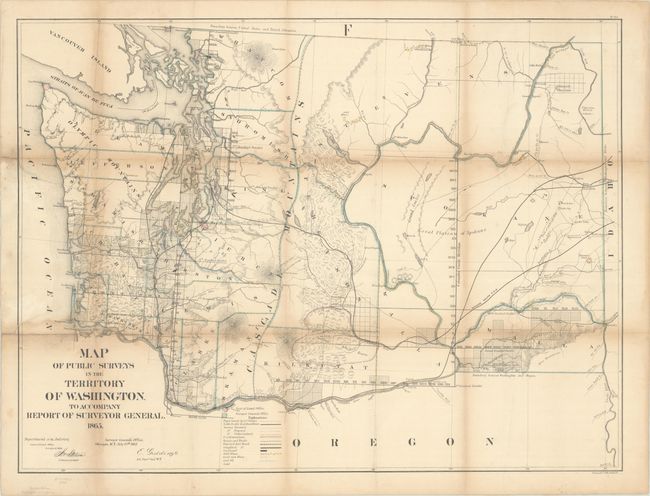
This hand-colored map of Washington Territory was issued in the GLO's annual report for 1866. It shows good detail in the coastal regions with additional completed surveying extending east along the Columbia River. Steven's proposed railroad route is shown and a legend at bottom identifies land offices, wagon roads, and minerals including silver, gold, lead and coal. Settlement is very sparse with only a few towns noted including Seattle, Vancouver, Walla Walla, and Olympia.
References: Phillips (Atlases) #1388-22.
Condition: B
Contemporary outline color. Issued folding and now flattened and backed with linen to reinforce and repair a couple of fold separations and two edge tears at left (2.5" and 6"). There is light toning along the folds and some minor loss at the fold junctions.