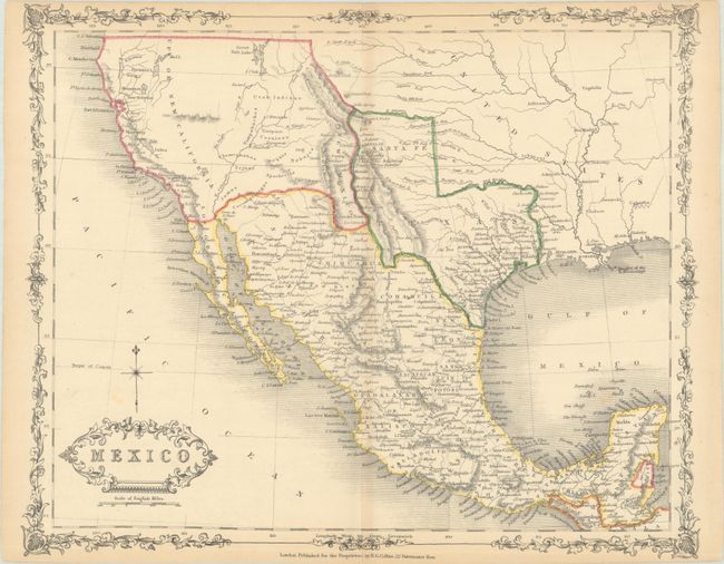
Subject: Southern United States & Mexico, Texas
Period: 1843 (circa)
Publication:
Color: Hand Color
Size:
11.8 x 9.6 inches
30 x 24.4 cm
This scarce map of the region highlights Texas in a large configuration, extending north to the Arkansas River and encompassing part of present-day New Mexico, including Albuquerque, Santa Fe, and Taos. New Mexico is cushioned between Texas and the Sierra de los Mimbres mountain range. The rest of the west is a vast Upper or New California, with plenty of tribal lands identified. The Great Salt Lake is named. In Mexico, the various states are delineated. The bottom left corner is adorned with a decorative title cartouche. An ornate border surrounds the map.
References:
Condition: B+
There is light toning along the centerfold and sheet's edges, a few minor spots, and a couple short edge tears at top that just enter the map border.


