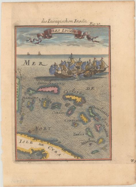
Subject: Bahamas
Period: 1684 (published)
Publication: Beschreibung des Gantzen Welt-Kreisses...
Color: Hand Color
Size:
4.2 x 5.8 inches
10.7 x 14.7 cm
This beautifully engraved chart covers the northern Caribbean, with a nice depiction of the Bahamas. The southeastern coastline of Florida is at the map's left edge, and a portion of Cuba is south of the Bahamas. The seas are fully engraved in a wave-pattern and are further decorated with a cluster of battling sailing ships shown above Grand Bahama Island, with a ribbon-style title cartouche floating above in the sky. From a German edition of Mallet's renowned Description de l'Univers.
References: Pastoureau, MANESSON-MALLET I B.
Condition: A
A crisp impression on a faintly toned sheet with a coat of arms watermark.


