Catalog Archive
Auction 197, Lot 34

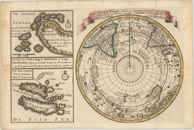
"De Zuid Pool waar in Aangetoont Werd Alle de Nieuwe Landen tot op Heeden toe Ondekt... [on sheet with] Het Gezigt van t' Land en Kaap der Besnydenis of Kaap Circoncision... [and] De Salomons Eilanden...", Keizer/De Lat
Subject: South Pole

Period: 1747 (circa)

Publication: Atlas Portatif

Color: Hand Color

Size:
10.8 x 7.1 inches
27.4 x 18 cm
Download High Resolution Image
(or just click on image to launch the Zoom viewer)

This sheet focuses on a map of the southern hemisphere, extending to the equator. Several sightings of land are noted near the South Pole. In the South Pacific, Dutch discoveries in Nieuw Holland are shown and there are partial coastlines of Tasmania and New Zealand. At left are two smaller maps: at top is part of Cape Circoncision on Bouvet Island in the South Atlantic; and on bottom is part of the Solomon Islands in the South Pacific.

References:

Condition: A

A sharp impression with contemporary outline color in the map and later color in the cartouche, issued folding on a sheet with the watermarks of a Strasbourg lily and "C&I Honig." There is light foxing that is almost entirely confined to the blank margins.

Estimate: $140 - $170

Sold for: $100

Closed on 4/24/2024

Archived