Catalog Archive
Auction 197, Lot 344

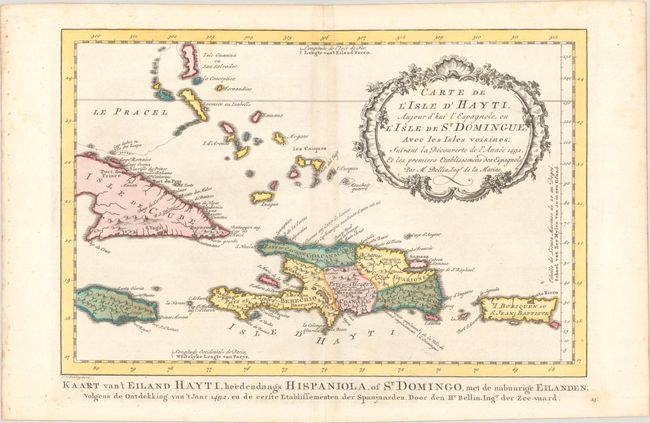
"Carte de l'Isle d'Hayti, Aujour d'hui l'Espagnole, ou l'Isle de St. Domingue, avec les Isles Voisines...", Bellin/Van Schley
Subject: Hispaniola

Period: 1773 (circa)

Publication: Raynal's Atlas Portatif

Color: Hand Color

Size:
13.1 x 8.7 inches
33.3 x 22.1 cm
Download High Resolution Image
(or just click on image to launch the Zoom viewer)

This decorative map of Hispaniola divided into five ancient cacicazgos, or Taino chiefdoms. The map extends to show Puerto Rico and the eastern portions of Cuba and Jamaica. The title is surrounded by a finely engraved cartouche. An alternative Dutch title appears below neatline: Kaart van't Eiland Hayti, Heedendaags Hispaniola, of St. Domingo...

References:

Condition: A

A crisp impression with full contemporary color on a sheet with faint toning along the centerfold and minor foxing that is mostly confined to the margins.

Estimate: $140 - $170

Sold for: $100

Closed on 4/24/2024

Archived