Subject: Western South America
Period: 1623 (circa)
Publication:
Color: Black & White
Size:
6.7 x 6.1 inches
17 x 15.5 cm
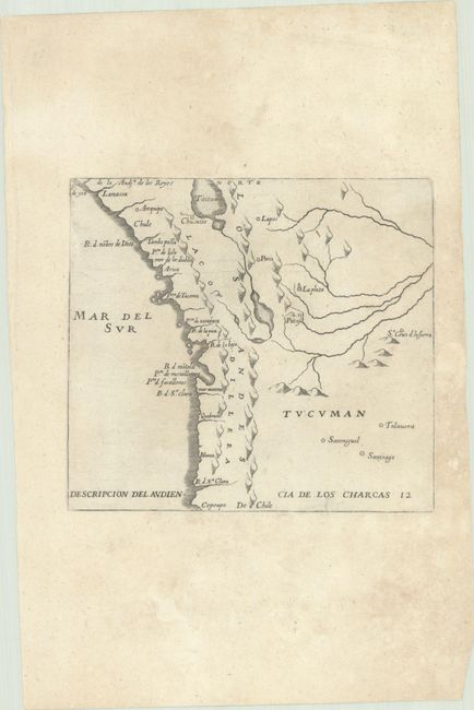
An early map of the Spanish colonial possession of Los Charcas, comprising southern Peru, western Bolivia, and northern Chile. The map extends from Lake Titicaca and Arequipa to Rio de Santa Clara. The lack of detail is in keeping with the official policy of protecting Spanish knowledge in the New World. Antonio de Herrera y Tordesillas was the official historian of Spain and the Indies. He compiled a history of the Spanish conquests and early explorations in the Americas. The various editions and translations of his works are scarce. This slightly reduced edition with less negative space in the Mar del Sur and the title spread across the bottom of the map, was first published in Zwolffter Theil der Newen Welt... in 1623.
References: Shirley (BL Atlases) G.HERR-3a #12.
Condition: B+
Minor toning and light dampstaining.