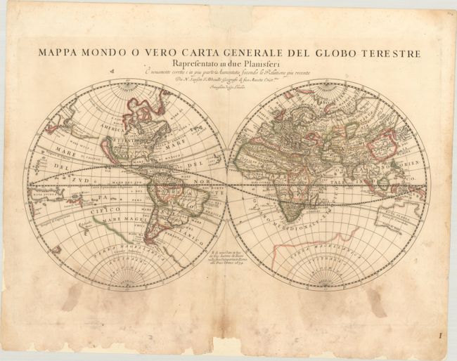
Subject: World
Period: 1674 (dated)
Publication: Mercurio Geographico
Color: Hand Color
Size:
21.6 x 11.3 inches
54.9 x 28.7 cm
This is an Italian edition of Sanson's double-hemisphere map of the world. The map is based on Nicolas Sanson's world map of 1651, updated by his sons Guillaume and Adrien in 1669. Australia is shown with a bit more definition, and Tasmania and New Zealand are only partially delineated. N. Danimarca is shown west of the Hudson Bay, here named the Mar Cristiana. California is shown as an island, and Acoma and Santa Fe are noted in the Southwest, with Acoma shown correctly atop a mesa. The coastline of Asia is shown with the discoveries of De Vries noted, including Terra di Iesso and a land called Yupi. The Great Lakes are not updated from the 1651 version; all five lakes are not shown here. Engraved by Jean Lhuilier.
References: Shirley #464; Shirley (BL Atlases) T.ROSS-1a #2.
Condition: B
A nice impression with full contemporary color on a sheet with a medallion watermark. There are scattered dampstains in the bottom half of the sheet, and some chips along the edges of the sheet that have been archivally repaired.


