Catalog Archive
Auction 197, Lot 429
"Sarnia Insula, Vulgo Garnsey: et Insula Caesarea, Vernacule Iarsey", Blaeu, Johannes
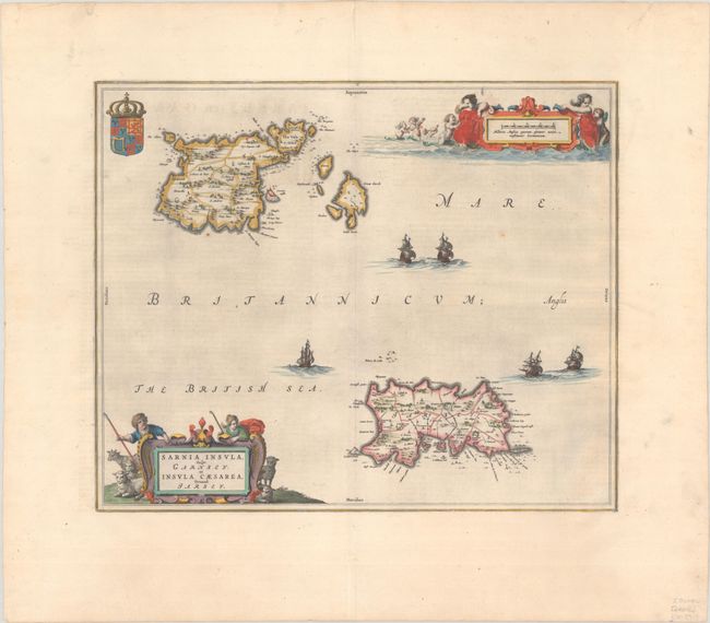
Subject: Channel Islands
Period: 1648 (circa)
Publication: Toonneel des Aerdrycks oft Nieuwe Atlas
Color: Hand Color
Size:
18.6 x 15.4 inches
47.2 x 39.1 cm
Download High Resolution Image
(or just click on image to launch the Zoom viewer)
(or just click on image to launch the Zoom viewer)