Subject: Ireland
Period: 1628 (circa)
Publication:
Color: Hand Color
Size:
16.3 x 13 inches
41.4 x 33 cm
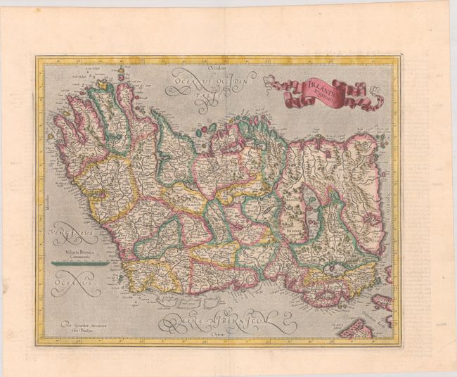
Very lovely, decorative map of Ireland oriented with north to the right. The map notes the four provinces of Leinster, Munster, Ulster, and Connacht, as well as many counties, cities, and towns, including Dublyn. The map features a stipple-engraved sea, Mercator's distinctive calligraphy, and a decorative, banner-style cartouche. French text on verso, published in 1628 or 1633.
References: Law, pp.19-20; Van der Krogt (Vol. I) #5900:1A.1.
Condition: A
A nice impression with full contemporary color on a bright sheet with a coat of arms watermark. There is minor marginal soiling and a crease in the bottom right corner of the sheet, not affecting the image.