Subject: Cannes, France
Period: 1953 (dated)
Publication:
Color: Printed Color
Size:
21.3 x 14.3 inches
54.1 x 36.3 cm
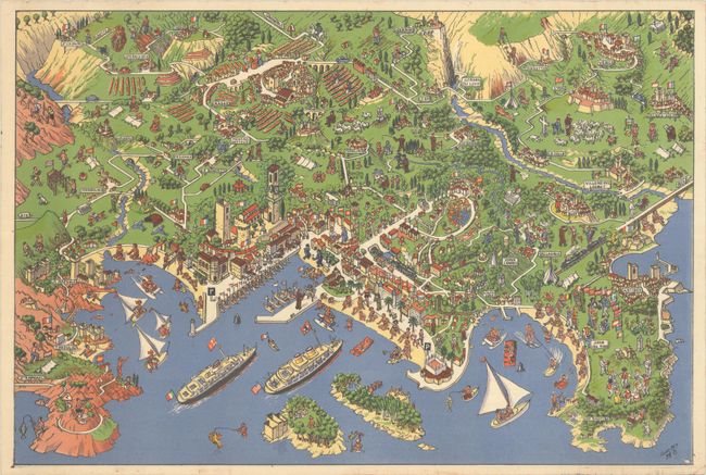
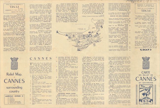
This terrific pictorial map centers on Cannes on the French Riviera. It extends along the coast from Theoule-sur-Mer and Point de l'Aiguille northwest to Antibes, and extends inland as far as Gourdon and Vence. Famous for its international film festival, beaches, and glamor, Cannes is here shown as a paradise of recreation and leisure. Charming cartoon illustrations depict the Promenade de la Croisette, hotels, villas, lines of boats in the port, beachgoers, cafe patrons, and more. People sail, jet ski, paddleboard, fish, and swim in the waters of the Mediterranean. In the surrounding areas, there are painters, hunters, cyclists, farmers, campers, hikers, golfers, and more, with compact illustrations capturing the architecture of the various towns and cities that are located. The map's artist is only identified by the initials "D.H.B." at bottom right. Verso features a small map of the area around the Croisette and English and French text with information for tourists.
References:
Condition: A
A clean and colorful example with a tiny abrasion at bottom right.


