Subject: Moscow, Russia
Period: 1597 (circa)
Publication: Civitates Orbis Terrarum, Vol. II
Color: Hand Color
Size:
19.3 x 13.8 inches
49 x 35.1 cm
Braun & Hogenberg's Civitates Orbis Terrarum or "Cities of the World" was published between 1572 and 1617. Within the six volumes, 531 towns and cities were depicted on 363 plates, providing the reader with the pleasures of travel without the attendant discomforts. Braun wrote in the preface to the third book, "What could be more pleasant than, in one's own home far from all danger, to gaze in these books at the universal form of the earth . . . adorned with the splendor of cities and fortresses and, by looking at pictures and reading the texts accompanying them, to acquire knowledge which could scarcely be had but by long and difficult journeys?" Braun and Hogenberg incorporated an astonishing wealth of information into each scene beyond the city layout and important buildings. The plates provide an impression of the economy and prominent occupations, and illustrate local costumes, manners and customs.
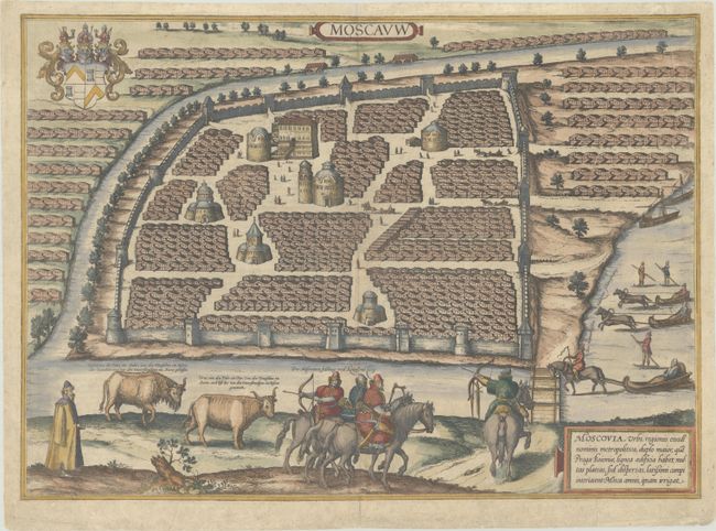
This elevated view of the old city of Moscow, drawn by Sigismund von Herberstein in 1547, depicts the city before much of it was destroyed in the great fire of that year. It depicts Moscow with starkly identical wooden houses, both within its walls and in the trader's quarter across the Neglinnaya River that forms a partial moat around the city. In the heart of the city is the Kremlin, labeled Arx, which was constructed between the years 1485 and 1530, and several Orthodox Russian churches. There are a number of horse-drawn sleighs and people on skis that, while inconsistent with the various vegetation shown in the scene, are meant to represent major modes of transportation used in the city. In the foreground there are Russian soldiers (Moscovites) that represent the growing military power of Moscow under Ivan IV Vasilyevich (Ivan the Terrible). Latin text on verso, published in either the 1597 or 1599 edition.
References: Fussel, pp. 179-181; Goss (Cities) pp.76-77; Van der Krogt (Vol IV) #2862.
Condition: A
A nice example with a couple of archivally repaired edge tears in blank margins and a couple of printer's creases in the image, one of which is reinforced with tissue on verso at top right.


