Subject: Sydney, Australia
Period: 1956 (circa)
Publication:
Color: Printed Color
Size:
14 x 18.8 inches
35.6 x 47.8 cm
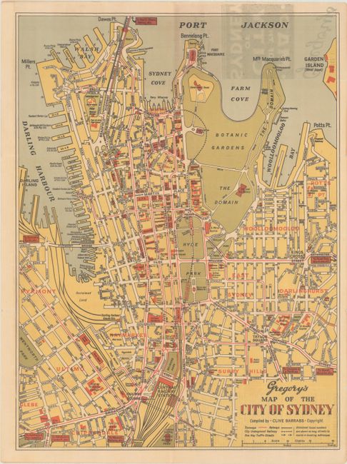
This detailed map of Sydney was compiled by Clive Barrass and extends from the Central Railway Station north to Port Jackson. Parks and the Botanic Garden are shaded in green while various buildings are named and shaded in red including the National Art Gallery, St. Mary's Basilica, Parliament House, museums, schools, public departments, and more. Wharves line Darling Harbor and Sydney Cove while a color-coded key at bottom further identifies tramways, railways, and the subway loop. Self-folding (3.3 x 7.4"). Circa date is based upon the subway being shown as completed (opened in 1956) coupled with no Sydney Opera House (construction began in 1959). We found no past sales records for this map.
References:
Condition: A
Clean and colorful with some show-through of the brochure cover at top right. Issued folding.


