Subject: United States
Period: 1855 (dated)
Publication: Atlas of the World
Color: Hand Color
Size:
26.5 x 15.8 inches
67.3 x 40.1 cm
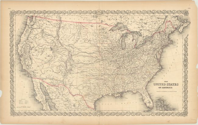
This great map features numerous early western territorial boundaries. Washington and Oregon Territories extend to the huge Nebraska Territory, meeting at the Continental Divide. Nebraska Territory in turn extends to the Missouri River where it borders a large Minnesota Territory. Utah Territory spans from California east to join Nebraska and Kanzas along the Rocky Mountains and Continental Divide. The very large New Mexico Territory comprises all of today's Arizona and part of Colorado. The map details the exploration routes of many expeditions including those of Marcy, Kearny, Fremont, etc., and locates the Santa Fe Trail and the Oregon Trail. It is filled with watershed information, scores of forts, Indian lands, and more. Surrounded by Colton's signature strap-work border. The map is hand colored in outline, which is very unusual for this issue.
References:
Condition: B+
There are a few spots of soiling, light toning along the centerfold, and short archivally repaired centerfold separations confined to the margins. There are several small edge chips and light toning along the sheet edges.