Subject: United States
Period: 1860-65 (circa)
Publication:
Color: Hand Color
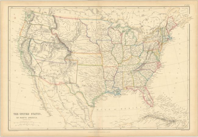
A. The United States, of North America. (General Map.), by Blackie & Son, circa 1860, hand color (20.3 x 13.5"). Very precisely engraved map with remarkable territorial boundaries. A large Texas includes today's Oklahoma. Oregon and Washington extend to the Continental Divide. Utah includes present-day Nevada and much of Colorado. New Mexico Territory includes Arizona, the Las Vegas area and a portion of southern Colorado. A huge Nebraska Territory fills the region between the Rocky Mountains and an enlarged Minnesota. Kansas extends to the eastern boundary of Utah. This interesting map is filled with place names, forts, watershed and topographical information. Drawn by J.W. Lowry and published in Glasgow, Scotland. Condition: Contemporary outline color with minor foxing and faint dampstaining confined to the blank margins. (B+)
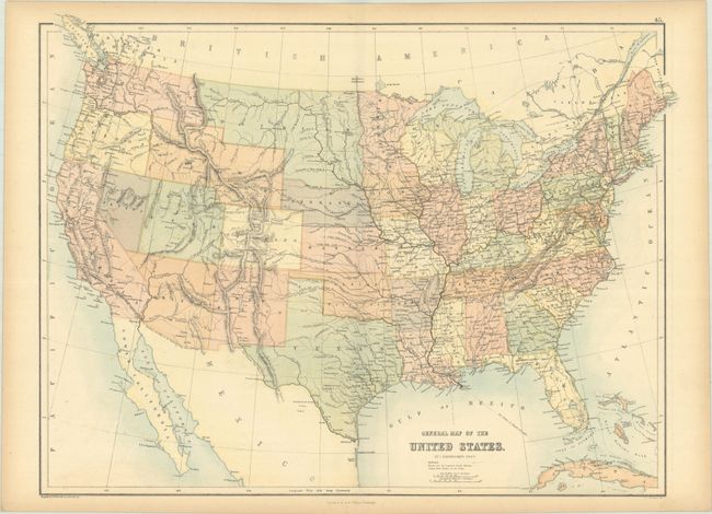
B. General Map of the United States, by Adam & Charles Black, circa 1865, printed color (22.2 x 16.7"). This map shows the west in a transitional state with Washington Territory extending to the Rocky Mountains, Arizona encompassing the southern tip of Nevada, and an enlarged Utah extending into eastern Nevada. Idaho Territory lacks its northern panhandle and Wyoming is attached to it, while Dakota Territory extends to include present-day Montana. The map presents good detail of the topography, river systems, and exploring routes in the west. Condition: There is a hint of offsetting and light toning along the sheet edges. (A)
References:
Condition:
See description above.